
Walk a New Orleans Street
Begin with one verified address, not a list of names. The City Property Viewer links the street line to a mapped parcel and current assessment data. Its parcel identifiers provide a stable bridge to deeds and tax records. Residency needs separate support. The Louisiana voter portal and historical directories can add names, but each reflects a different date and purpose.
The strongest street directory result is a chain of labeled evidence. Ownership, registration, and occupancy are not interchangeable. Preserve the date shown by each custodian, and keep the GeoPIN or PARID when two buildings share a similar address.
- Enter the house number and street in Property Viewer, then select the correct result.
- Save the GeoPIN, tax bill number, lot, square, situs address, and owner fields.
- Check touching parcels to walk the same side of the street in order.
- Use the owner and legal description in the Civil Clerk land index.
- Test the exact ZIP, address, and unit in the voter portal, then use a criss-cross volume for an earlier household.
This sequence prevents a common error: treating the first name returned as proof of every current resident. It also leaves a clear route back to the original record.
For a long street, work in short blocks and keep one row per parcel. Record the street number, unit, GeoPIN, owner label, source date, and any deed instrument number before moving to the next lot. This method makes gaps visible. Condominiums, double houses, corner lots, and vacant land can otherwise make the order seem wrong. Check the map after each unusual result. A parcel may face one road while using a mailing line from another, and a corner building may have more than one valid site address. The map and legal description settle that question better than a name alone.
Search New Orleans Parcels
The City Property Viewer accepts an address, owner name, or tax bill number. Address help omits periods, and owner searches use last name, first name, then middle initial. Tax bill numbers do not autocomplete. Once zoomed beyond level 15, a parcel click opens the property card. A chain icon creates a shareable GeoPIN link.
| Field | How it works | Why save it |
|---|---|---|
| Address, name, tax bill | Text search with autocomplete | Finds the parcel card |
| Owner format | Last name, first name, middle initial | Helps with common names |
| Parcel click | Available above zoom 15 | Opens property facts |
| Layers | Lot, square, zoning and district context | Checks the correct site |
| GeoPIN link | Chain icon after selection | Preserves a stable reference |
The weekly GIS data may show site and mailing addresses, owner fields, use code, lot, square, block, dimensions, PARID, and tax bill ID. It is assessment evidence, not a recorded survey or title opinion.
New Orleans Address Terms
Several fields look alike but answer different questions. The situs line identifies the taxable site. The mailing line is where notices go. A legal description identifies land through lot, square, district, or another recorded description and often survives a street-name change.
- Parcel
- A mapped unit of land used by the assessor and GIS.
- Situs address
- The physical location assigned to the taxable parcel.
- Plat
- A recorded drawing showing lots, boundaries, or a subdivision.
- Criss-cross directory
- A directory sorted by address or phone rather than surname.
An absentee owner, trust, company, or separate mail destination can make the mailing address differ from the site. That difference is a clue, not proof of a person's home.
New Orleans Records by Street
No single Orleans Parish roll supplies a complete household. Each source adds one kind of evidence, with a distinct date and access path.
| Address record | Custodian | Evidence | Access |
|---|---|---|---|
| Parcel and assessment | Assessor and City GIS | Owner, addresses, GeoPIN, lot and square | Free web search; data request |
| Tax bills | City Treasury | Name, assessed site and annual bill, 2008–2026 | Free historical search |
| Permits and code | City One Stop | Applicant, record type, dates, description, 2007-present | Free search and CSV |
| Recorded land acts | Civil District Court Clerk | Parties, act, instrument and legal description | Paid remote, office, request |
| Voter address search | Secretary of State | Available voters at one address | Free; protected fields withheld |
| Historical directories | NOPL and City Archives | Occupant, business, phone clues after 1932 | Print, microfilm, databases |
Property and permit data can be requested when a website cannot answer the question. Older land acts may require an instrument number and help from the Clerk's Land Records Division.
Note: Label every name as owner, voter, deed party, applicant, or directory resident so unlike records are never merged into one claim.
Map New Orleans Street Geography
New Orleans and Orleans Parish cover the same political area, yet the grid reflects the river, old faubourgs, municipal districts, West Bank, and later lakefront growth. Property Viewer moves from one parcel to those touching it. The City GIS portal adds zoning, historic districts, squares, service districts, and neighborhood context.
Use the map to confirm physical relationships, not identities. Its measure tool is for orientation, not survey work. Property geometry shows which lots face a street, but cannot prove who sleeps in each building. The LandBase service limits responses to 1,000 records, so large extracts need pagination and an update date.
Open the official New Orleans LandBase parcel service shown in the successful project capture.
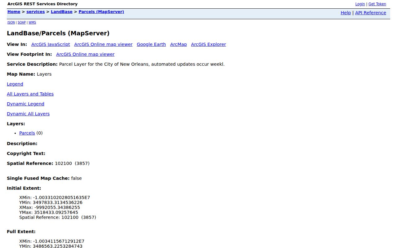
The service connects street geometry to GeoPIN data, supplying a stable map key without claiming a list of occupants.
Follow New Orleans Street Ownership
The Civil Clerk Online Records system organizes land acts by party, date, record set, document type, and instrument number. Start with the assessed owner, search that buyer as grantee, and inspect the act for the seller and legal description. Then search the seller as a prior grantee. Continue only while the lot, square, or legal description remains consistent.
Coverage windows differ. The land index starts February 18, 2014, while land images reach 2005. Mortgage and conveyance indexes cover separate 1987–2014 and 1989–2014 ranges. General Clerk data entry goes to 1985, but does not guarantee an image. Save every CIN, MIN, or former archive number.
Remote access is paid and uses a separate image-print escrow account. In-office research and emailed public-record requests are key alternatives. Original notarial material reaches 1735 at the Land Records Division, evidence of a New Orleans street directory trail far older than the web portal.
Check New Orleans Street Work
The One Stop search covers permits, licenses, planning projects, and violations from 2007 forward. Its address input uses the street without direction or suffix. Results can be filtered by record type and filing date, sorted, and exported as CSV.
A permit may identify an applicant, contractor, business, project description, or filing event. It does not establish occupancy. Match the result to the parcel, work date, and record number, then distinguish it from the tax owner and directory resident.
Note: A code or permit entry records city business at an address; it does not name everyone who lived there.
Repair Old New Orleans Addresses
The present house-number system was adopted in the early 1890s. Before then, numbering was not standardized. The City Archives street-number index covers 1852–1938 and records old right- and left-side numbers, the new hundred block, cross streets, and municipal districts. It does not promise an exact conversion for each building.
The street-name index supplies old and new names, an ordinance or date when known, districts, and notes. Streets did not have to be named by City Council ordinance until 1923, and changes after 1938 fall outside the index. Search both names and number systems, the closest cross street, and the deed's square and lot.
This geographic quirk is strongest in the French Quarter, early faubourgs, and former municipalities. A current street directory can miss the right nineteenth-century household unless the address is normalized first.
Test a New Orleans Voter Address
The Louisiana voter address search asks for ZIP, street address, and an optional apartment or lot. It returns available voter records for one address, not a public block roster. Address records are separated from voter records, so spelling, unit format, and status affect results.
Louisiana law withholds Social Security numbers, full birth dates, driver-license numbers, email, and protected records. Address Confidentiality Program participants use substitute addresses. A voter hit supports registration at the record date, not a full census of the home.
New Orleans Street Directory Limits
Public street records omit many people by design. Renters, roommates, children, mail recipients, utility customers, and visitors do not appear on a parcel card. DMV addresses are private. A voter may be protected, inactive, or entered under another unit format. Deed parties can be companies, donors, mortgagees, representatives, or owners who live elsewhere.
Lawful use. New Orleans address records support family history, property research, civic questions, and fraud prevention. Never use them to stalk, harass, threaten, or expose a protected person.
Commercial compilations can mix dates, people, and addresses. Official records are narrower, but name their purpose and custodian. When the question shifts to one older household, consult the New Orleans city directory collections and keep the volume year with every result.